Environmental Insights Explorer Expands: 100 Australian councils and counting
Environmental Insights Explorer
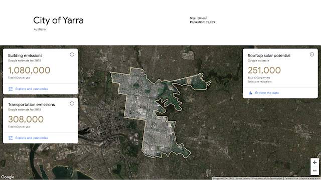
Reducing greenhouse gas (GHG) emissions is a crucial step in fighting the climate crisis. And cities now account for more than 70 percent of global emissions. But measuring exactly which activities—whether it’s buildings, cars, or public transport—are contributing to emissions, and by how much, is complex. Without this information, cities can neither understand the challenges they face, nor the impact of their environmental policies.
This is the problem we’re working to solve with Environmental Insights Explorer (EIE), an online platform that provides building and transportation emissions, as well as solar potential analysis to make it easier for cities to measure progress against their climate action plans. Launched in 2018 for a handful of cities around the world including Melbourne, with Sydney, Canberra and Adelaide then added in 2019, EIE has helped councils accelerate GHG reduction efforts. Today, we’ve expanded EIE data access to thousands of cities worldwide, including 100+ Australian councils.
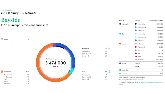
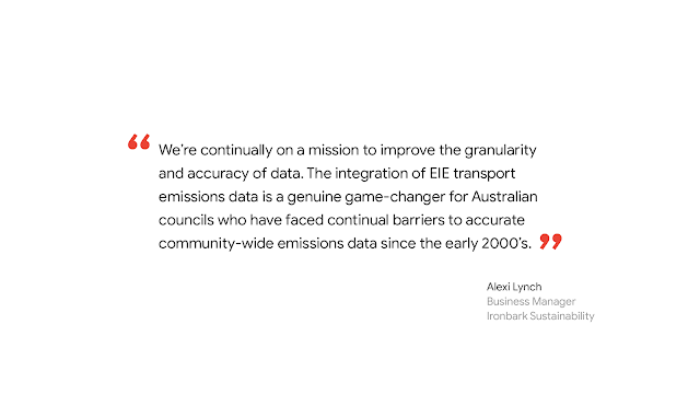
To scale data access to local governments, policy makers and community groups, we’re also developing partnerships with leading Australian organisations, councils, and climate change experts. This includes a new partnership with Ironbark Sustainability and Beyond Zero Emissions to make EIE transportation data available for 100+ councils in Snapshot—a free tool that calculates major sources of carbon emissions, including stationary energy, transport, waste, agriculture, and land-use change. Snapshot allows municipalities to easily compare their sources of carbon emissions. This data integration will provide updated GHG profiles and enable local government policy decision-making for more than 86 percent of the country's population to put councils on a fast track for delivering commitments, building local resilience, and ensuring economic recovery.

Accelerated city-wide analysis
By analysing Google’s comprehensive global mapping data together with GHG emission factors, EIE estimates city-scale building and transportation carbon emissions data with the ability to drill down into more specific data such as vehicle-kilometres travelled by mode (automobiles, public transit, biking, etc.) and the percentage of emissions generated by residential or non-residential buildings.
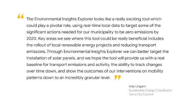
The insights that EIE provides have traditionally required many months of research, and a lot of resources for cities undertaking a climate action plan. Using Google’s proprietary data coupled with machine learning capabilities, we can produce a complete survey of a city that can be assessed very quickly. In this way, EIE allows cities to leapfrog tedious and costly data collection and analysis.
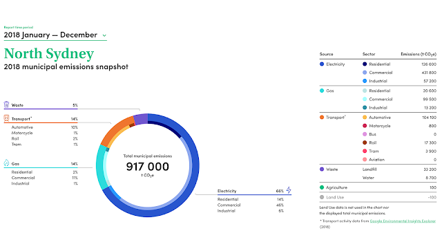
EIE transport data now available in Snapshot for 100+ councils
The next chapter
Over the next few months, we’ll be working together to help Australian councils learn more about data insights from EIE and expand data coverage to more councils. We hope that by making EIE data accessible to more councils across Australia, we’ll help nurture an ecosystem that can bring climate action plans to life.