Helping more people stay safe with flood forecasting

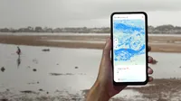
Caption: Google Flood Hub shown on a mobile device
Since early 2023, New Zealanders have faced extreme weather events unlike anything we’ve seen before. Historic flooding and cyclones have ripped through communities, and while natural disasters are common here - causing an average of NZ$790 million in damages each year - they’re unfortunately increasing in frequency and intensity due to climate change, threatening people’s safety and livelihood. Globally, it’s estimated that flooding affects over 250 million people each year.
As part of our work to use AI to address the climate crisis, we’re expanding our flood forecasting capabilities to 80 countries, including here in New Zealand. With the addition of 60 new countries across Africa, the Asia-Pacific region, Europe, and South and Central America, our platform Flood Hub now includes some of the regions with the highest percentages of population exposed to flood risk and experiencing more extreme weather, covering 460 million people globally.
Governments, aid organisations, and individuals can use Flood Hub to take timely action and prepare for floods, seeing locally relevant flood data and flood forecasts up to 7 days in advance — an increase from last year, when information was only available 48 hours in advance.
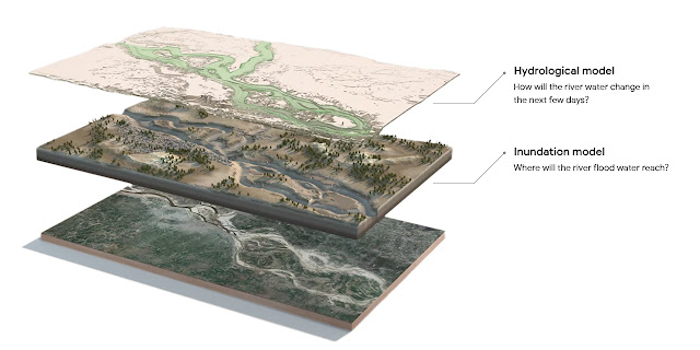
Flood Hub’s AI is based on diverse, publicly-available data sources, such as weather forecasts and satellite imagery. The technology then combines two models: the Hydrologic Model, which forecasts the amount of water flowing in a river, and the Inundation Model, which predicts what areas are going to be affected and how deep the water will be.
Caption: Image shows the Hydrological and Inundation Models
We’re working to expand flood forecasting alerts in Search and Maps to make this information available to people when they need it the most.
Using AI to help people prepare for flooding
In 2018, we kicked-off flood forecasting in India and expanded to Bangladesh to help combat the catastrophic damage from yearly floods. Due to advances in our global AI and machine learning forecasting models, in 2022 we further rolled out our technology to 18 more countries, paving the way for today’s global expansion.
Flood Hub is part of our Crisis Response work to provide people access to trusted information and resources in critical moments. For over a decade, we have been partnering with front line and emergency workers to develop technology and programs that help keep people safe, informed and out of harm’s way.
In addition, to support communities that have been impacted by the flooding and cyclones in New Zealand this year, through our Google.org giving campaign, which combines Google employee donations with a Google.org grant, we raised over NZ$200k total, for The Center for Disaster Philanthropy to support on the ground recovery.
As we continue improving our AI-based global models for flood forecasting, we will keep supporting at-risk communities with technology to mitigate the effects of climate change.