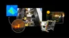
The first satellite for the FireSat constellation officially made contact with Earth. This satellite is the first of more than 50 in a first-of-its-kind constellation designed to use AI to detect and track wildfires as small as a classroom (roughly 5x5 meters). It launched from Vandenberg Space Force Base in California aboard SpaceX's Transporter-13 mission.
Currently, many wildfire authorities depend on satellite imagery that’s low-resolution or only updated a few times a day. FireSat will advance the science and practice of fighting wildfires by providing high-resolution imagery updated globally every 20 minutes, helping emergency responders catch wildfires before they become destructive.
FireSat is a collaboration between Google Research, Muon Space, Earth Fire Alliance, Moore Foundation, wildfire authorities and others. Funding for the constellation’s first satellites comes in part from Google.org, which has provided $13 million through the AI Collaborative: Wildfires, an initiative to harness AI’s potential in reducing the economic, humanitarian and environmental damages from catastrophic wildfires.
Learn more about the launch of FireSat in this post.