Our favorite moments from 20 years of Google Earth

General summary
Google Earth is celebrating 20 years of helping people explore the world. You can now access historical Street View imagery within Google Earth. Professionals can also use new features to evaluate building designs and access city-level insights.
Summaries were generated by Google AI. Generative AI is experimental.Basic explainer
Google Earth is 20 years old and it helps people see the world. It has lots of pictures from planes, satellites, and even the street. People use it to learn about the Earth and help their communities. Now, you can even see old Street View pictures on Google Earth.
Summaries were generated by Google AI. Generative AI is experimental.Haiku-ish
Okay, here are three haiku summarizing the Google Earth article, mentioning relevant Google products and services:
Haiku 1:
Earth turns twenty now,
Google Earth, Street View expands,
History unfolds.
Haiku 2:
From reefs to new finds,
Timelapse shows Earth's changes,
Earth View's beauty shines.
Haiku 3:
Gemini helps plan,
Maps aid in site evaluation,
New tools for all.
Explore other styles:
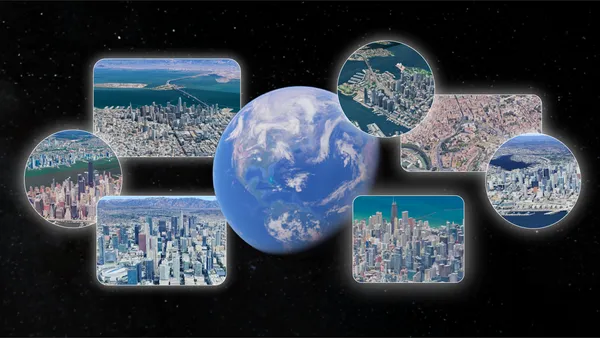
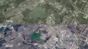
For 20 years, Google Earth has helped us explore and understand the world. With billions of images across aerial photography, satellite imagery, Street View and 3D visuals, Google Earth offers a stunning view of our world. Over the past two decades, people have used it to build more resilient cities, stronger communities and a healthier planet. In just the past year, people searched for places in Google Earth more than 2 billion times.
Today, we’re celebrating this milestone birthday by bringing historical Street View imagery to Google Earth. Now you can explore the wonders of the planet from even more viewpoints, whether it’s a bird’s eye view or at street level. We’re also looking back at Google Earth’s biggest moments:
2005: Google Earth went viral at launch and was downloaded 100 million times in just its first week. Two months later, Hurricane Katrina hit, and we quickly worked with the National Oceanic and Atmospheric Administration (NOAA) to make updated imagery available to first responders on the ground — a preview of our future impact.
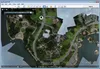
Google Earth’s interface in 2005.
- 2008: Scientist Chris Simpson discovered fringing coral reefs, a rare type of reef often called “the rainforest of the sea,” off the west coast of Australia after spotting an unusual formation in Google Earth satellite imagery. Fringing reefs provide habitat and food for a quarter of marine life and can help researchers better understand what’s happening in the ocean.
- 2010: Scientists used Google Earth to identify caves and fossil sites in satellite imagery that aided in the discovery of an entirely new hominid species, Australopithecus sediba.
- 2012: We published imagery of Oakland, California using kites and balloons. This marked the first time we’d captured imagery from anything besides planes or satellites, thanks to the Public Laboratory for Open Technology and Science. This program allowed anyone with an inexpensive digital camera, a helium balloon and a few other simple items to take aerial photos.
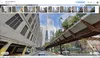
Imagery from 2012 taken from kites and balloons.
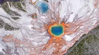
2014: To highlight the beauty of our planet, we launched Earth View, an easy-to-use Chrome extension that creates digital wallpaper and screensavers from a collection of the most beautiful landscapes seen from space.
Earth View image of the Marshall Islands.

- 2016: The film “Lion” detailed the journey of Saroo Brierley, who used Google Earth imagery to find the family he was separated from at age five. Saroo painstakingly traced his way back home to India and reunited with his biological mother in 2011 after 25 years apart.
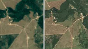
- 2017: We updated Google Earth Timelapse, a comprehensive picture of the Earth's changing surface, with 24 million satellite images taken over 35 years. We also compiled them into an interactive 4D experience.
- 2019: For years, people created their own maps from our imagery. To help make this easier, we added new tools to Google Earth, including overlaying lines, shapes, text, images and videos. Some of the projects made with these tools included a 3D tour of renaissance architecture in Italy, a history tour of the Hudson River in New York and more.
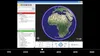
- 2023: Google Earth got a redesign and new features for professionals, including the ability to evaluate building and solar design options within minutes. Thanks to this update, professionals can virtually explore a site on Google Earth and evaluate feasibility for a building design or a solar site, reducing the need for in-person visits.
In Google Earth, professionals can evaluate feasibility for a building design or a solar site.

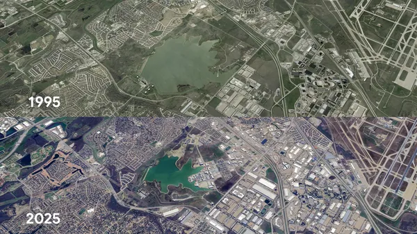
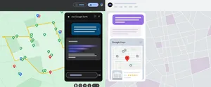
2024: We added historical imagery to Google Earth on web and mobile, making it easy for a much larger audience to explore our rich library of satellite and aerial imagery. We also introduced Gemini in Google Earth to help urban planners access deeper, city-level insights, like information about locations of EV chargers.
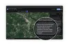
Gemini in Google Earth.
2025: Last year, #somewhereonGoogleMaps started trending on social media, with people around the globe using historical Street View to virtually time travel and see how a place evolved over time. Now, you can access historical Street View imagery right from Google Earth — and if you use Google Earth in a professional capacity, you can easily access new datasets, like tree canopy coverage for cities, land temperatures and more. Learn more in our blog post.
Here’s to you and our entire Google Earth community for all the incredible ways you’ve used Google Earth since 2005. Cheers to the next 20! 🥳