See the planet change with new imagery in Google Earth Timelapse
Timelapse in Google Earth, which lets you visualize how the earth has changed over time, is now updated with new imagery from 2021 and 2022. Watch time unfold and witness nearly four decades of planetary change from 1984 to 2022 — all thanks to this 4D interactive map, made from millions of satellite photos.
Timelapse videos of Mount Burges, Australia; Merida, Mexico; Mato Grosso, Brazil; Aral Sea, Kazakhstan / Uzbekistan
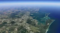
Timelapse in Google Earth is a global, zoomable time-lapse video of the planet, providing evidence of earth’s dynamic changes — from irrigation systems emerging in the deserts of Egypt and meandering rivers shifting over time in the Amazon rainforest in Pucallpa, Peru to volcanic eruptions, logging and wildfires changing the landscape of California’s Lassen National Forest. The imagery also captures ways cities have adapted to combat climate change — like offshore wind farms in Middelgrunden, Denmark and a large-scale solar installation in Granada, Spain.
You can also view a library of over 800 Timelapse videos for more than 300 locations at g.co/TimelapseVideos. From researchers to teachers, anyone can use these videos to better understand our changing planet. And people are using this imagery to convey the effects of these changes, like the 2022 documentary The Territory which uses Timelapse to show the devastation of deforestation across the Amazon and its effect on local communities.
Timelapse in Google Earth is possible because of the commitment to open and accessible data through NASA and the United States Geological Survey’s Landsat program (the world’s first and longest-running civilian Earth observation program) and the European Union’s Copernicus program with its Sentinel satellites.
Check out the updated visualization today in Google Earth at g.co/timelapse, and on YouTube via g.co/timelapsevideos.
In Qesm Al Wahat Ad Dakhlah, Egypt crop circles stand in stark contrast to the surrounding desert landscape due to center-pivot irrigation in this remote agricultural outpost.
In Pucallpa, Peru meandering rivers in the Amazon rainforest intersect with local towns.
In Lassen National Forest in California, wildfires, a volcanic eruption and logging alter the landscape. The distinct logging pattern shows clean geometric shapes.
In Middelgrunden, Denmark an offshore wind farm hugs the coast.
At the Andasol Solar Power Station in Granada, Spain a large-scale solar installation nests between mountain ranges.
In Kuala Lumpur, Malaysia urban expansion and infrastructure development create urban sprawl.


