A marine biologist uses Maps to explore under the sea

Just under the water lies one of the biggest mysteries of the Great Barrier Reef: blue holes. These underwater sinkholes give researchers a rare look at ocean life and how we can protect it. Until a few years ago, only two blue holes were documented in the entirety of the Great Barrier Reef — they are hard to find and even harder to get to.
With the help of Google Maps, marine biologist Johnny Gaskell and a team of researchers are finding previously unknown blue holes. In 2017, after witnessing Cyclone Debbie destroy many of the reefs in its path, he set out to find more blue holes. Home to hundreds of species of coral and serving as a protective waters for larger marine life, these formations give scientists a view of history buried in undisturbed sediment layers and clues about how to better protect coral reefs.
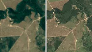
Using Google Maps’ satellite view, Johnny followed the cyclone’s path to pinpoint areas along the reef that might have been spared from damage. That’s when he spotted perfect circles along the reef, indicating a potential blue hole. The formation he identified was south of the Whitsundays in the Hard Line Reefs, a difficult-to-reach area of the Great Barrier Reef that’s dangerous to navigate. Despite this, Johnny and a team of divers headed out into the unknown, unsure of what — if anything — awaited them.
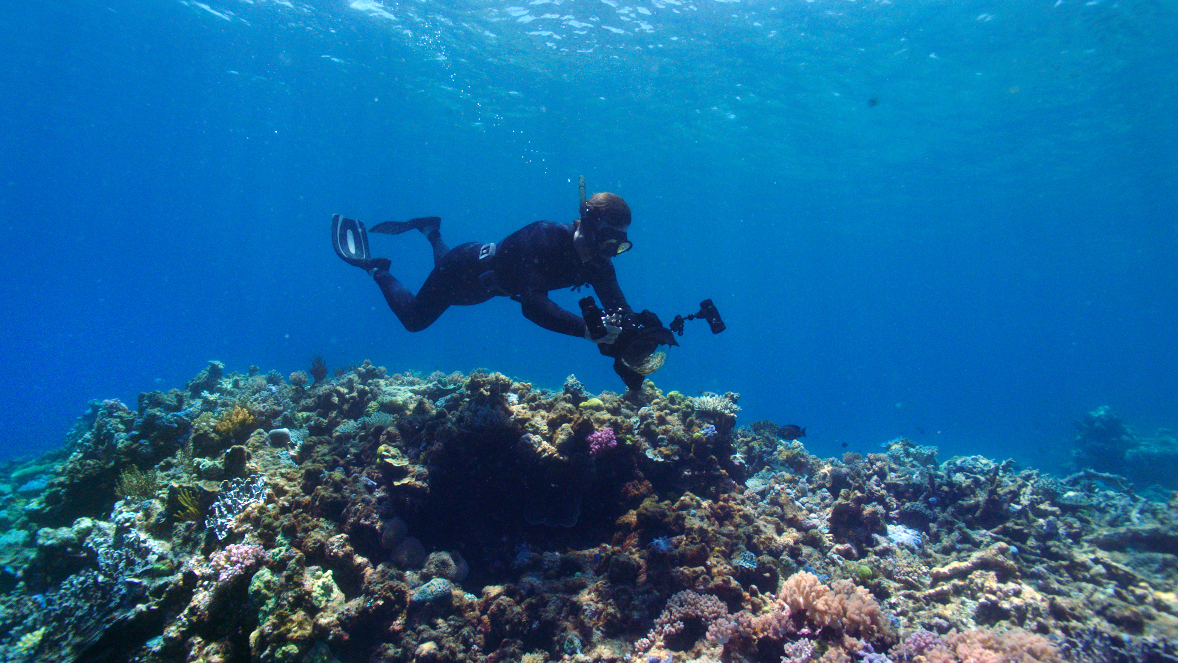
With the satellite view of Google Maps on their phones, they navigated their boats through narrow channels in unsurveyed waters until the blue dot on their map was directly over the blue hole. Johnny dove in and found healthy coral formations that have sat undisturbed, possibly for centuries. Along the edges were delicate birdsnest corals, vibrant giant clams and huge branching staghorn corals. In the stillness of the blue hole’s center, there were green sea turtles, giant trevally and sharks that all called the dark, cool water home.

Using Google Maps’ satellite view, Johnny spotted perfect circles along the reef, indicating a potential blue hole. These rare underwater sinkholes offer vital information about life in the ocean.

Once they navigated to where they thought the blue hole was, Johnny dove in.

Underwater were healthy coral formations.

Home to over 400 species of hard coral, like these, the Great Barrier Reef is the largest living structure on earth.
Scientists use the layers of sediment that collect at the bottom of blue holes to learn information about conditions in the past.

Blue holes are biodiversity hotspots. Here, fish swim around the bright yellow coral.
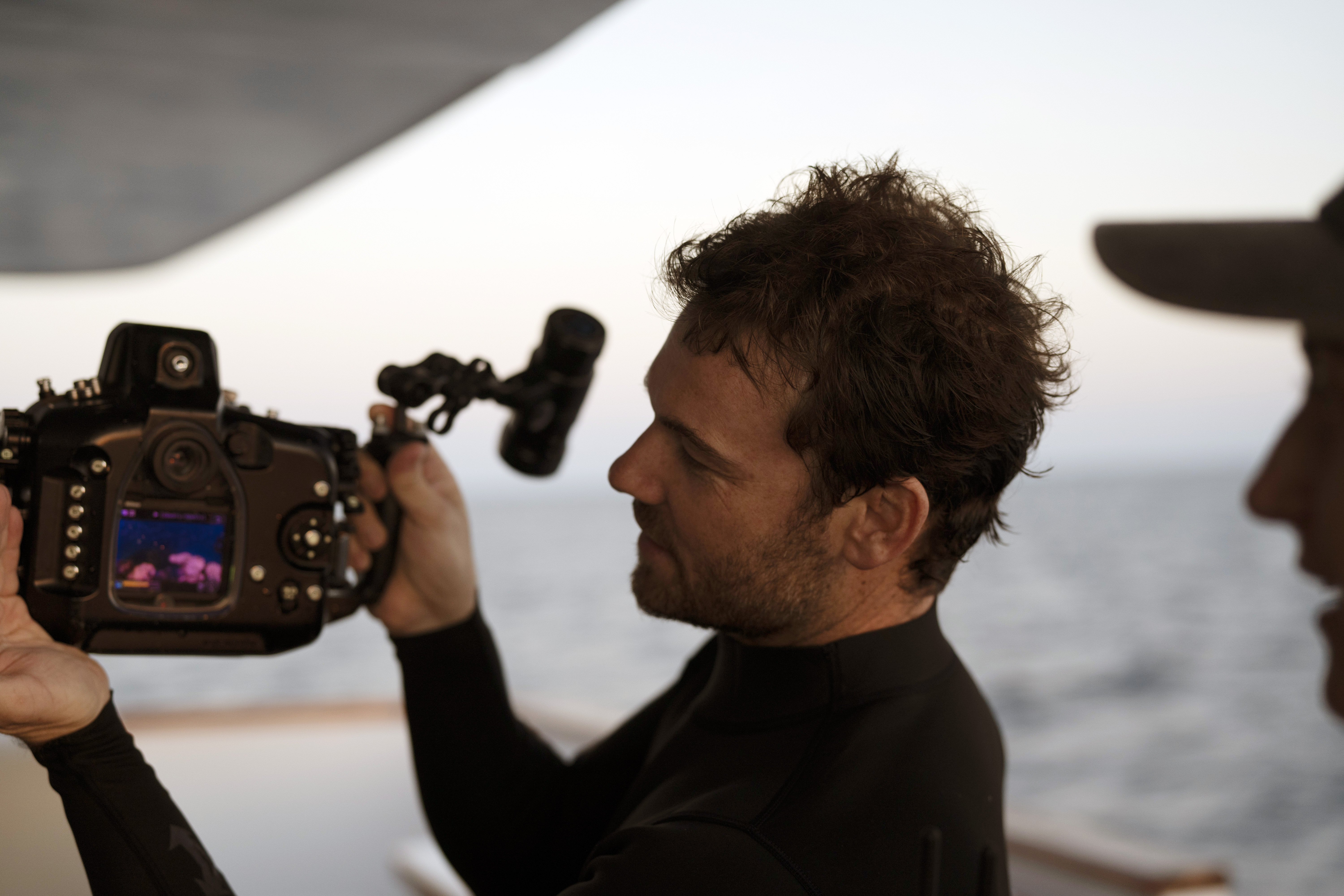
Johnny captured images of the blue hole to help create a snapshot of reef conditions.
With the help of Google Maps, a discovery that would have taken years of underwater exploration on the seafloor is now allowing researchers to expand our understanding of the world’s largest ecosystem. Today, Johnny is still working to build a snapshot of coral reef conditions. Working with Citizens of the Great Barrier Reef and the Great Reef Census project, they are using geotagged images to give everyone — from scientists to students — a better idea of what’s going in depths of the water whether they dive in or not.
In 2021 the Great Reef Census is expanding to reach more reefs, collect more data, and broaden its research goals. To join the efforts, sign up as a Citizen or contribute directly via the project’s fundraising page.