How AI and imagery keep speed limits on Google Maps updated
Speed limits play an important role in making roads safer for everyone, but sometimes it can be hard for drivers to know what the speed limit is. For example, you might be driving in low-visibility conditions like on a foggy day, in a different area with unfamiliar traffic laws, or simply not know what the speed limit is at a particular moment.
To help drivers navigate, Google Maps displays speed limit information for streets around the world. This information not only helps drivers stay safe, but also helps automakers as they work to enhance assisted driving capabilities in cars.
Here’s a look at how we use AI and imagery to identify speed limits, and how we use speed limits to build more helpful products.
How AI helps identify speed limits around the world
To map the world, we rely on data from many sources; the same is true for how we understand speed limits. One important source is authoritative data from local governments that helps us know what the default speed limits are for different types of roads when there is no signage. For example, in California, 25 miles per hour is the default speed limit in residential areas.
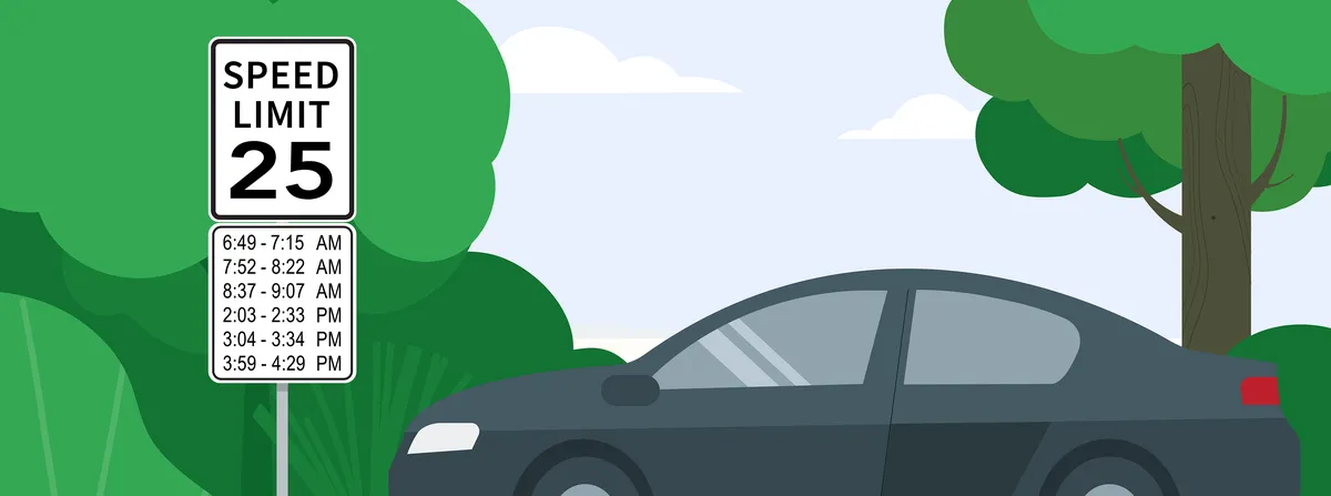
Still, there are a lot of roads that have different speed limits during different times or weather conditions. To capture all of these nuances within Google Maps, we use imagery and AI.
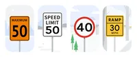
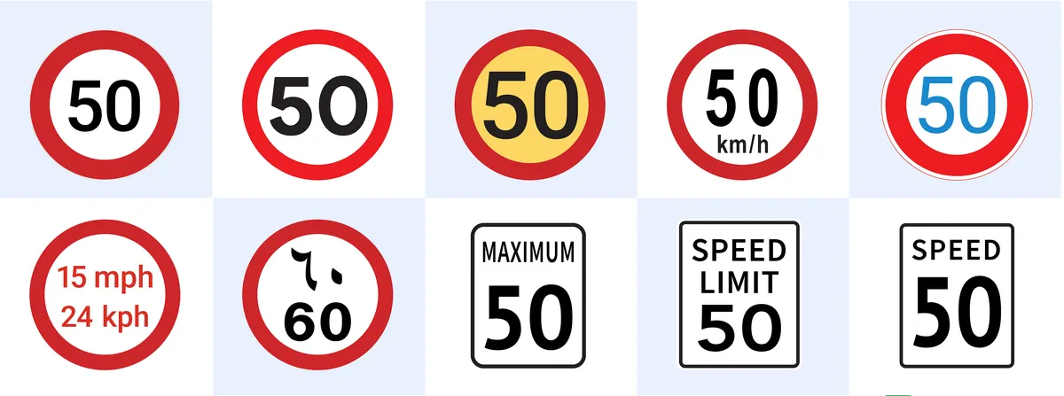
Our sophisticated AI models are designed to identify speed limit information from sources like our Street View imagery, as well as third-party imagery. We train the AI models on hundreds of different types of signs from all over the world so no matter how different a sign looks, the AI model can still detect the speed limit. For example, signs in the U.S. might have “speed limit” written on them, while signs in Germany might only show the number. Once the AI model identifies a sign, we use GPS information from the image to match it to its exact geographic location so we know precisely when to change the speed limit displayed to you on Google Maps based on where you are on your route.
How traffic patterns keep speed limits updated
Imagery and data provide a solid foundation for our model of real-world speed limits. However, speed limits are constantly changing, which makes them challenging to update. Things like construction, community input and long-term traffic conditions may temporarily or permanently change the speed limit.
To tackle this problem, Google Maps analyzes traffic trends to understand if there could be a speed limit change. For example, if our trends show cars are consistently traveling below the speed limit, it might be an indication that the speed limit has decreased. This can happen if a new school is built or if a local government determines that a road is a high-risk area for accidents.
If we suspect the speed limit in an area has been updated, we cross-reference the change with multiple sources — like official data from local governments and refreshed Street View imagery — to confirm or deny the change. In areas where we don’t have recent Street View imagery available, we request images of the specific stretch from third-party partners that already gather roadway information to do things like improve delivery routes and road safety. If the partner has photos available, we use a combination of AI and help from our operations team to identify the sign in the images, extract the new speed limit information, and update Google Maps.
How our speed limit data is powering future driving technologies
This information is also useful for automakers building cars with assisted driving or fully automated driving features. For many of these features to work, cars need to know the speed limit just like a human would. Being able to do this accurately and precisely is becoming an ever-pressing issue for automakers — especially as more policies regulate assisted-driving features.
For example, the EU’s General Safety Regulations (GSR) require that new vehicles registered after July 2024 have an intelligent speed assistance (ISA) feature that displays the legal speed limit at all times and warns drivers if they go over it. To meet the requirements, vehicles must deliver accurate speed limits for at least 90% of any drive.
Cars’ built-in cameras and sensors can help car manufacturers capture some of the required speed limits. But there are similar challenges that make speed limit signs hard to detect like inclement weather, physical barriers and poor sign placement. So while vehicle sensors are a critical component — and will even help keep Maps updated for everyone — our data plays a big part in completing the picture for automakers. In fact, the ISA feature in Volvo’s EX30 just passed the EU's GSR certification by using our speed limit data. This means that the EX30 can reliably display the legal speed limit, even when there aren't clear signs on the road.
Speed limits play a big part in keeping roads safe for drivers, cyclists and pedestrians alike. And we’ll continue to invest in our technology so that automakers can build highly-accurate assisted driving features, and drivers can feel confident on roads anywhere in the world.


