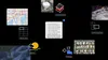
Imagine being able to get complex insights about our planet — like the impacts of hurricanes or best locations for city infrastructure — simply by asking Gemini. Geospatial Reasoning, a new research effort introduced today by Google Research, aims to provide comprehensive answers about our world, complete with detailed plans and data visualizations.
Google Research’s novel geospatial AI foundation models, including our latest remote sensing foundation models, are trained on vast amounts of satellite and aerial imagery. These models can analyze images that are undecipherable to the human eye and support natural language queries about their features, such as changes to buildings or impassable roads.
Geospatial Reasoning will combine these models with Gemini 2.5 to understand questions in natural language, and intelligently plan and orchestrate analysis across diverse geospatial data sources — including maps, socioeconomic data, satellite imagery and your own proprietary datasets.
Learn more about Geospatial Reasoning and foundation models on the Google Research blog, or express interest in our trusted tester program to try out the new models.