A breakthrough in wildfire detection: How a new constellation of satellites can detect smaller wildfires earlier
Wildfires are becoming increasingly common due to hotter and drier climates around the world. Until now, firefighters have had to rely on satellite imagery that’s either low resolution or only updated a few times a day, making it difficult to detect fires until they’ve grown larger than a soccer field.
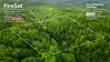
Google Research has teamed up with leaders in the fire community to create FireSat — a purpose-built constellation of satellites designed specifically to detect and track wildfires as small as a classroom (roughly 5x5 meters). With FireSat, authorities will have high-resolution imagery that is updated globally every 20 minutes, helping them respond to fires before they become destructive.
To kickstart this work, Google.org provided $13 million in funding to the initiative led by the Earth Fire Alliance, a nonprofit established to launch the FireSat constellation, with additional support from the Moore Foundation.
A constellation of satellites that can detect smaller wildfires with better frequency
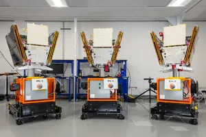
To achieve this breakthrough in wildfire detection, the Google Research team contributed to the development of custom infrared sensors for the satellite — in partnership with Muon Space and the Environmental Defense Fund — that could better detect small-scale fires. Using AI, FireSat will rapidly compare any 5x5 meter spot on earth with previous imagery, while also combining factors like nearby infrastructure and local weather, to determine if there's a fire. To validate our detection model for smaller fires and establish a baseline dataset for the AI, we flew the sensors over controlled burns. Next, Muon Space plans to launch the first satellite in early 2025, with the full constellation to follow in the coming years.
Once launched, FireSat will provide near real-time information about the location, size and intensity of early-stage wildfires so firefighters and emergency responders can respond quickly and effectively. In addition to supporting emergency response efforts, FireSat’s data will be used to create a global historical record of fire spread, helping Google and scientists to better model and understand wildfire behavior and spread. This will expand our existing work on fire simulation in partnership with scientists in the U.S. Forest Service.
FireSat is designed specifically to detect and track wildfires when they’re as small as a classroom.
Our commitment to researching wildfires
This project is the latest addition to Google Research's ongoing efforts to help communities around the world help address the impacts of climate change. Since 2020, we’ve used AI models to surface alerts and features that provide helpful information to people who are near a wildfire through wildfire boundary tracking, which is now available in over 20 countries. Earlier this year we also released FireBench, an open-source ML benchmark dataset for wildfire research.
As we work to expand our wildfire detection, data and AI play an important role in providing critical information to emergency responders and opening up new opportunities to scientists. We’ll continue to partner with the fire community in the face of the growing threat of wildfires.