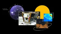
Inside the launch of FireSat, a system to find wildfires earlier

Juliet Rothenberg vividly remembers evacuating her neighborhood during a California wildfire four years ago. “After we evacuated, we constantly stared at satellite imagery to see whether the fire had crossed the road because if it had, we knew our community would burn,” she says. Fortunately, that didn’t happen — but during her evacuation, Juliet waited hours for updates because better data “didn’t exist.”
Wildfires are an increasingly common threat around the world with record-breaking burns from Australia to the Amazon and the United States. Current satellite imagery is often low-resolution, infrequently updated and unable to detect small fires. “We had no idea if our neighborhood was safe,” Juliet says. “All we received was updated satellite imagery every 12 hours, while throughout the Bay Area, the sky was red and full of smoke.” But what was even more shocking, she said, was realizing that wildfire authorities didn’t have much better data than she did.
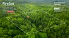
Juliet was already well aware of the need for better wildfire detection. Juliet is the Product Director of Climate AI efforts at Google Research, which includes a team contributing to FireSat, a satellite project designed to detect and track wildfires early — before they’re hugely destructive. FireSat’s first satellite launched this week. When the full constellation is live in the coming years, it will detect a fire that’s merely 5x5 meters — about the size of a classroom — within 20 minutes. It’s a major step forward in the science and practice of mitigating wildfires. Here’s a look at how this project came to be.
Finding fires earlier and more accurately
Google Research and satellite manufacturer Muon Space are among the founding partners in Earth Fire Alliance, the nonprofit home for FireSat. Funding for the constellation’s first satellite comes in part from AI Collaboratives: Wildfires, an initiative created by Google.org that convenes leading nonprofits, academic institutions, government agencies and companies around the joint goal of using AI to prevent the devastating impact of wildfires. As part of AI Collaboratives, Google.org provided $13 million to support the launch of the first satellite in the FireSat constellation.
Funding from Google.org and the Moore Foundation meant the real work on FireSat could start. Co-founder Chris Van Arsdale was more than motivated. "We knew we really needed to get a handle on CO2 mitigation for wildfires,” says Chris, who works on climate and energy projects at Google. CO2 emissions create a vicious cycle, Juliet explains: Warmer, dryer climates cause wildfires to occur more often and in new places. These fires release more CO2 that traps heat in the atmosphere, causing temperatures to rise and climate change to accelerate. Improving wildfire management also protects lives, homes and communities facing these threats.
FireSat expands on the wildfire response work we first launched in 2020 (and most recently utilized in Los Angeles) that uses AI and satellite imagery to create a wildfire boundary map. This allows people who turn to Google Search and Maps for helpful information to see the approximate size and location of wildfires in their area, while also notifying nearby communities with information on how to stay safe.
While making substantial progress on AI-based wildfire detection, the team recognized the limits of current satellite imagery and began pursuing advances for the future of spotting fires. “Some satellites today take a picture about every five minutes, but they’re coarse,” Chris explains. “You’re lucky if you can see the city of San Francisco in the image. You’re certainly not going to see where a fire is until it’s a few acres in size.” Plus, a lot of wildfires start from lightning strikes in the mountains — where planes and drones might not be flying over and gathering images consistently enough to notice until a fire is out of control.
The team considered various options for detection, including high-altitude drones, before settling on satellites. In large part, Chris says, that was thanks to the price of satellites decreasing significantly during this exploration phase. And it was also because they found a collaborator in Muon Space, a company that designs, builds and operates satellites.
Building (and testing) a new AI model
Using AI, FireSat rapidly compares a spot — wherever it is in the world — with previous imagery of that location, considering factors like nearby infrastructure and local weather to determine if there’s a fire.
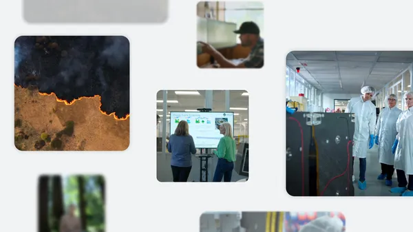
“Differentiating between real fires and random ‘noise’ in the environment was a challenge,” Chris says. “We had to determine where to draw the line between what is a real fire versus things like sensor issues or misaligned pixels.” Developing a practical scientific solution required massive amounts of testing and refining; they even loaded a plane with sensors to experiment with their progress. “The first time we used the plane, one of our team members lit a barbeque and a firepit in his backyard so we could fly the plane over and test it,” says Erica Brand, one of the project managers for FireSat. “And the sensors were able to pick it up.”
Readying for launch — and the future
At the time of these interviews, the first FireSat satellite had just arrived at the SpaceX launch site.
And just yesterday, members of the Google Research team watched as the rocket — and the satellite — hit the skies. “Since launch dates move a lot, rather than book a flight we figured we’d just all meet and drive,” Erica says. “We called it ‘the minivan caravan plan.” While thrilled to see their efforts take flight, they’re more eager to see how firefighters and emergency responders use FireSat to react more quickly and effectively.
And big picture, FireSat will help advance the basic science of wildfires. The satellite data will contribute to a global historical record of fire spread so scientists can better model and understand wildfire behavior. “FireSat is more than just an emergency response tool,” says Juliet. “It’s also an incredible tool for reducing greenhouse gas emissions. It’s actually really beautiful that the constellation contributes to reducing climate change — while also responding to it.”