3 imagery updates to Google Earth and Maps
Our world is in constant motion. Cities expand, landscapes evolve and the climate continues to reshape our globe. To help people visualize these changes and learn more about the world around them, we’re announcing new updates to Google Earth and Street View.
Travel back in time with Earth — and plan projects more efficiently
Maybe you want to travel back in time and see what your neighborhood looked like decades ago. Or you want to understand how forests have been affected by human activity and the changing climate. All of this will soon be possible thanks to our new historical imagery in Google Earth on web and mobile, which makes it easy to explore our library of satellite and aerial imagery — some of which goes as far back as 80 years.
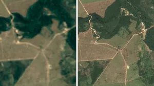
When exploring, you’ll see a sharp contrast in how geography has evolved in many places. Take this 2018 image of Lake Oroville, a reservoir in northern California that saw significant water reduction after multi-year droughts. Compare that with its 2023 image, which shows how a series of rains gradually filled the reservoir back to maximum capacity — providing water storage, electricity from power generation and a space for water activities, like swimming and kayaking. Historical imagery allows you to follow the lake’s evolution in striking detail.
Lake Oroville experienced dire levels of water reduction (2018). By 2023, a series of rains gradually filled the reservoir back to maximum capacity.

Historical imagery can also show dramatic changes over longer periods of time. In places like London, Berlin, Warsaw and Paris, you can even explore imagery from as far back as the 1930s. For example, below is a black-and-white photo of San Francisco in 1938, taken by Oakland Airport pilots. During this period, you can see that ports were mainly used for shipping and industry — compared to the 2024 image, where you see the piers dotted with restaurants and cruise ships docked in the harbor. Want to browse even more of the world’s changes? Check out Timelapse in Google Earth, an interactive experience built from millions of satellite images showing a stunning visualization of how our planet is changing over time.
San Francisco in 1938, compared to San Francisco in 2024. Available in Google Earth historical imagery.
In addition to helping you browse Earth’s changes, we're also making it easier for researchers and organizations to use Google Earth for projects, like creating custom maps. Soon we'll start showing projects right from a newly designed home screen in Google Earth, making it even easier to collaborate with your teams. You can learn more about these updates on our developer blog.
Expanding Street View imagery in nearly 80 countries
While Google Earth has a vast repository of satellite and aerial imagery, Street View displays over 280 billion images collected from our Street View cars and trekkers. With Street View, you can virtually explore every continent right from your living room — and even places like the Great Barrier Reef and the International Space Station. Now, we're launching one of the biggest updates to Street View yet, with new imagery in almost 80 countries — some of which will have Street View imagery for the very first time.
You’ll be able to explore the picturesque countryside of Bosnia and its medieval villages, the sandy mountains surrounding the capital of Namibia, the alps and castles of Liechtenstein and the beautiful rivers of Paraguay. You can even virtually wander the streets of foreign cities to see shops and buildings up close.
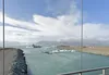
Street View imagery taken from the bridge overlooking Diamond Beach in southeast Iceland, where icebergs float in the water.
Keep an eye out for updated Street View images from around the world, in countries like Australia, Argentina, Brazil, Costa Rica, Denmark, France, Iceland, Japan, Mexico, New Zealand, Philippines, Rwanda, Serbia, Spain, South Africa, Switzerland, Uruguay and many more. And our newest camera — just 15 pounds and mountable on any car — will make it easier for us to bring Street View to even more places in the future. As our planet changes, this updated imagery helps keep the map fresh for people everywhere.
Here are just a few Street View images we captured this year:
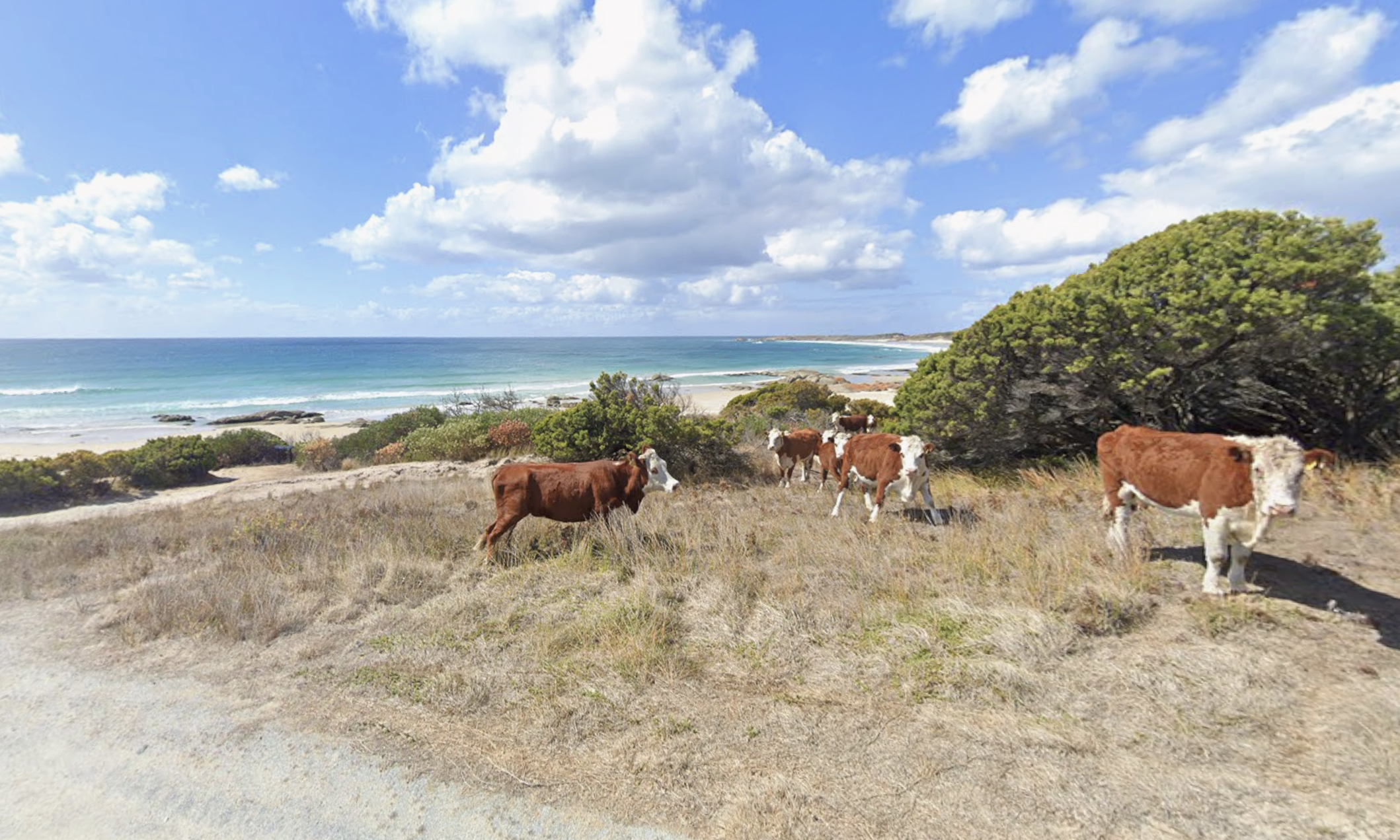
Street View image of Disappointment Bay, Tasmania

Street View image of Fukue Island, Japan
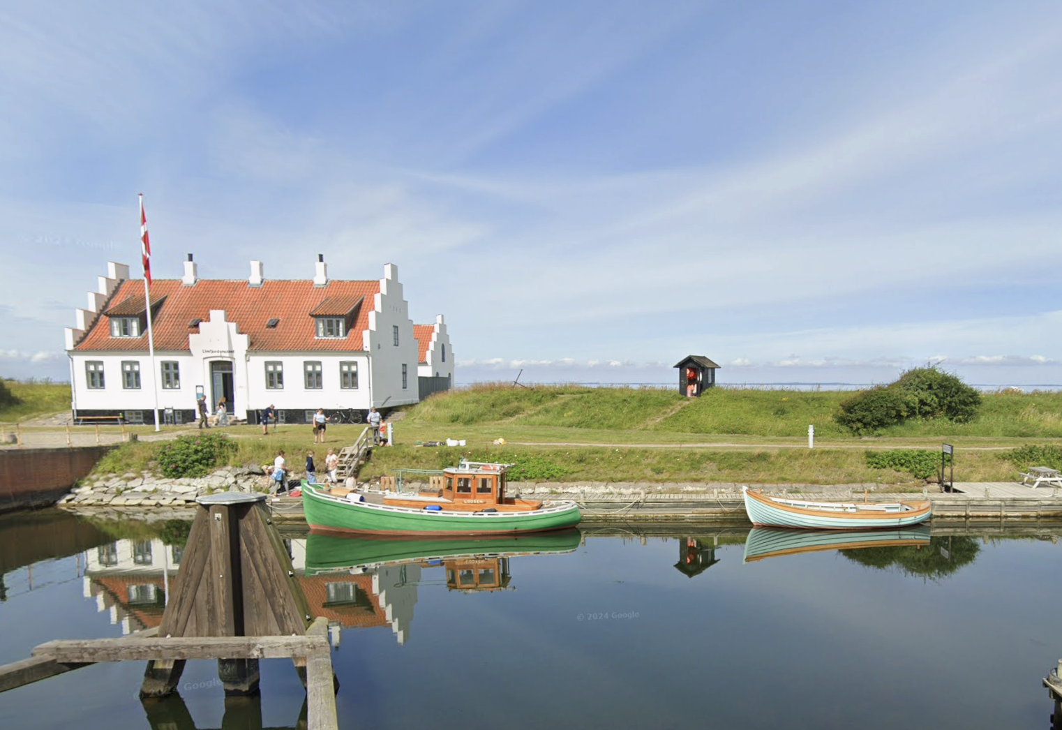
Street View image of Logstor, Denmark

Street View image of Skane county, Denmark
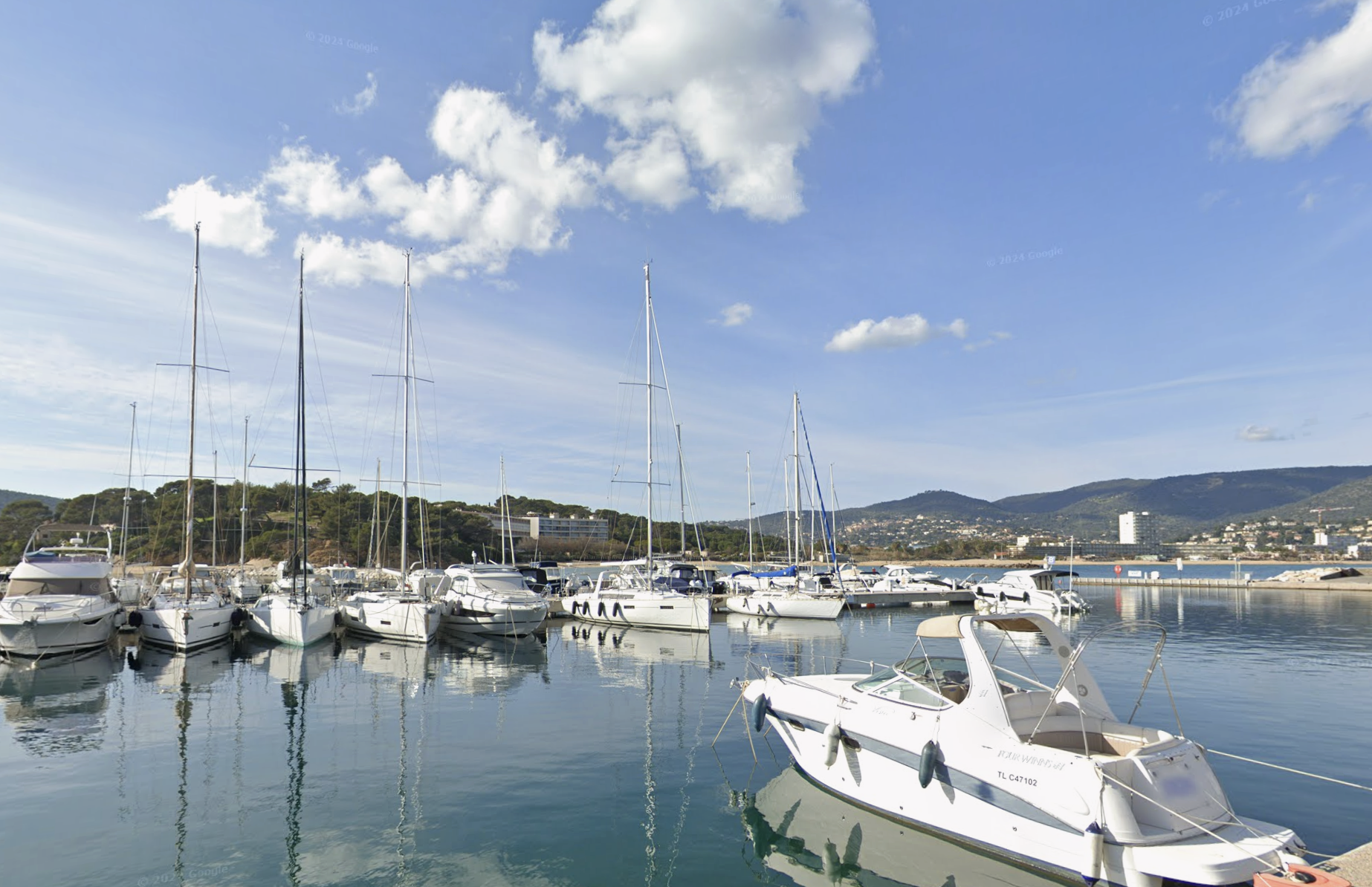
Street View image of Quai d’Honneur, France

Street View image of Mokau, New Zealand

Street View image of Tasman, New Zealand

Street View image of Rio de Janeiro, Brazil

Street View image of Oaxaca, Mexico
Sharpening imagery with new AI models
In addition to making imagery available in more places, we’re sharpening satellite imagery across Google Earth and Maps. Starting this week, you’ll see a brighter, more vibrant globe made possible thanks to our cloud-removal technology. We've used our Cloud Score+ AI model, trained on millions of images, to recognize and remove things like clouds, cloud shadows, haze and mist. At the same time, this model keeps real-world weather patterns — like ice, snow and mountain shadows — visible on the map. The result is a refreshed global mosaic that gives you a clearer, more accurate look at Earth.
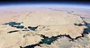
Egypt's Toshka Lakes, recently formed in the Sahara Desert from Lake Nasser overflow. Composite image enhanced with Cloud Score+ .
These updates help us understand our planet’s past and present, while also offering an expanded, more beautiful view of our world.