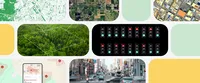
8 ways we’re using AI to help cities be more sustainable

General summary
With the world's urban population set to surge by 2.5 billion by 2050, Google is leveraging AI to help cities become more sustainable. From combating urban heat islands and promoting cool roofs to optimizing traffic lights and suggesting fuel-efficient routes, Google's initiatives are making a positive impact on the environment. Additionally, Google's mapping projects, wildfire detection systems, and real-time wildfire information are empowering communities to adapt to climate change and protect biodiversity.
Summaries were generated by Google AI. Generative AI is experimental.Bullet points
Title: 8 AI-powered ways to build sustainable cities
- Using AI to create tools that help cities adapt to climate change.
- Helping cities reduce urban heat islands and plant more trees.
- Optimizing traffic lights to reduce vehicle emissions.
- Suggesting fuel-efficient routes on Google Maps.
- Mapping buildings around the world to provide essential services.
- Detecting wildfires earlier and providing real-time information.
Explore other styles:
By 2050, two out of three people on Earth will be living in or around a city, according to the United Nations. That means between now and 2050, around 2.5 billion more people will move to cities. With this massive population change, it’s more important than ever to develop tools that help communities address and adapt to the impacts of climate change today — and build a more sustainable world for tomorrow.
At our Research@ event in New York City today, the Google Research team discussed how we have a unique opportunity to accelerate scientific progress using AI. And one way we’re doing just that is by working with governments, academics and other experts to make sure our cities have a sustainable future. Here are just a few projects we’re working on with this goal in mind.
1. Helping cities cool down “urban heat islands”
Rising temperatures have a disproportionate impact on people who live in urban heat islands — areas where structures like roads and buildings absorb heat and re-emit it. Google Research is applying AI to satellite and aerial imagery to build a Heat Resilience tool, helping cities understand how to reduce surface temperatures through planting trees or using highly-reflective surfaces, like cool roofs. We’re working with 14 cities on piloting the tool. Using the Heat Resilience tool, Miami-Dade county plans to develop policies that incentivize developers to take heat mitigation measures.
2. Showcasing the value of cool roofs
Cool roofs are designed to reflect sunlight and absorb less heat, and they’re especially helpful in communities that may not have access to reliable air conditioning. They keep buildings cooler, and help prevent heat-related illnesses. Google Research used Google’s aerial imagery and AI algorithms to generate high-resolution roof solar reflectivity measurements. This way, urban planners and governments can identify which areas would benefit most from cool roofs, and measure the impact of their interventions. The City of Stockton, California has used the Cool Roofs tool to gather data for potential projects and opportunities to reduce urban heat islands.
3. Locating the best places to plant trees
The underlying technology behind Tree Canopy in our Heat Resilience tool is also part of our Environmental Insights Explorer. It combines AI and aerial imagery so cities can understand their current tree coverage and better plan urban forestry initiatives. The City of Austin has already used the tool to prioritize planting trees in vulnerable areas of the city and even used it to help place bus shelters to increase shade. American Forests has also used Google’s tree canopy data to expand their Tree Equity score tool to all major urban areas in the U.S., covering 80% of the U.S. population, and expanding to the U.K.
4. Reducing vehicle emissions at traffic lights
Road transportation is a significant contributor to greenhouse gas emissions. At city intersections, pollution can be 29 times higher than on open roads. Project Green Light uses AI to make recommendations for city engineers to optimize existing traffic lights and reduce emissions from stop-and-go traffic. Since Google Research’s first pilot in 2021, Green Light has spread to more than a dozen cities across the world, including Rio de Janeiro, Seattle, Bengaluru and Boston.
5. Offering fuel-efficient routes on Maps
Google Maps uses AI to suggest fuel-efficient routes: ones that take a similar amount of time, but that have fewer hills, less traffic and more consistent speeds throughout. It’s estimated to have helped enable more than 2.9 million metric tons of GHG emissions reductions since the feature launched in late 2021 to the end of 2023 — that’s equivalent to taking approximately 650,000 fuel-based cars off the road for a year.
6. Mapping 1 billion buildings around the world
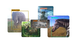
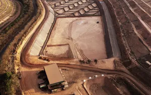
Maps are crucial to providing essential resources like electricity, healthcare and emergency services to people around the world. But not everywhere is easily mapped — like informal settlements or hard-to-reach terrain. To help address this gap, our Open Buildings project uses AI to map over 1 billion buildings around the world. It takes publicly available, low-resolution satellite images and uses AI to determine what type of buildings the images show. Researchers have used the dataset to measure how cities have adapted to environmental disasters, like how a city in Indonesia rebuilt after a tsunami. Google Research recently expanded the project with a new dataset, Open Buildings Temporal 2.5 Dataset, which tracks change from 2016 through 2023, and contains information about building height for the first time. The goal is to share this information with partners who can use it for sustainable and inclusive urban development.
7. Detecting wildfires earlier
Wildfires are becoming increasingly common due to hotter and drier climates around the world — but until now, satellite imagery that tracked wildfires was only available at a low-resolution or not updated frequently enough. This made it difficult to detect fires until they’ve grown larger than a soccer field. Now, we’re partnering with leading wildfire authorities to launch FireSat, a new global satellite constellation designed specifically to detect and track wildfires the size of a classroom by providing higher-resolution imagery within 20 minutes. Using AI and satellite imagery, we can detect wildfires in their early stages, often before they are reported through traditional channels. This technology can help fire authorities respond more quickly and effectively, potentially saving lives, property and natural resources.
8. Providing real-time information about wildfires
FireSat adds to our existing efforts around tracking wildfires and alerting people nearby. Using AI, we are able to show detailed wildfire boundary tracking in Search and Maps and through location-based push notifications — and just this summer, we expanded those wildfire boundary maps to 15 countries across Europe and Africa. These maps provide near real-time information about the size and location of active fires, helping firefighters and other emergency responders — and when wildfires can be kept at bay, biodiversity is protected, and Earth is healthier overall.