New ways we’re helping reduce transportation and energy emissions
Responding to climate change calls for systemic, global action to transition to a sustainable future for everyone. But tackling a problem at the scale of climate change can seem intimidating.
To help, we’re continuing to develop technology that can surface helpful information so people, cities and organizations can make more sustainable choices. We’ve focused especially on transportation and energy, which are the two sectors that contribute the most to global emissions. Here’s some of the progress we shared today at Sustainable with Google.
Transportation
Cutting down on traffic and travel emissions
Project Green Light is one of the ways we’re helping improve transportation. The product uses AI to help city traffic engineers optimize traffic lights at intersections to improve traffic flow and cut emissions. With this information, cities can make cost-effective updates to existing infrastructure to reduce the number of stops cars make at red lights.
Today, we’re announcing the availability of Green Light in 12 cities across four continents, helping to save fuel and lower emissions for up to 30 million car rides monthly. Early numbers from Project Green Light indicate the potential to reduce stops by up to 30% and reduce emissions at intersections by up to 10%. 1 We’ll be expanding Green Light to more cities across the globe next year.
Helping people get from A to B more sustainably
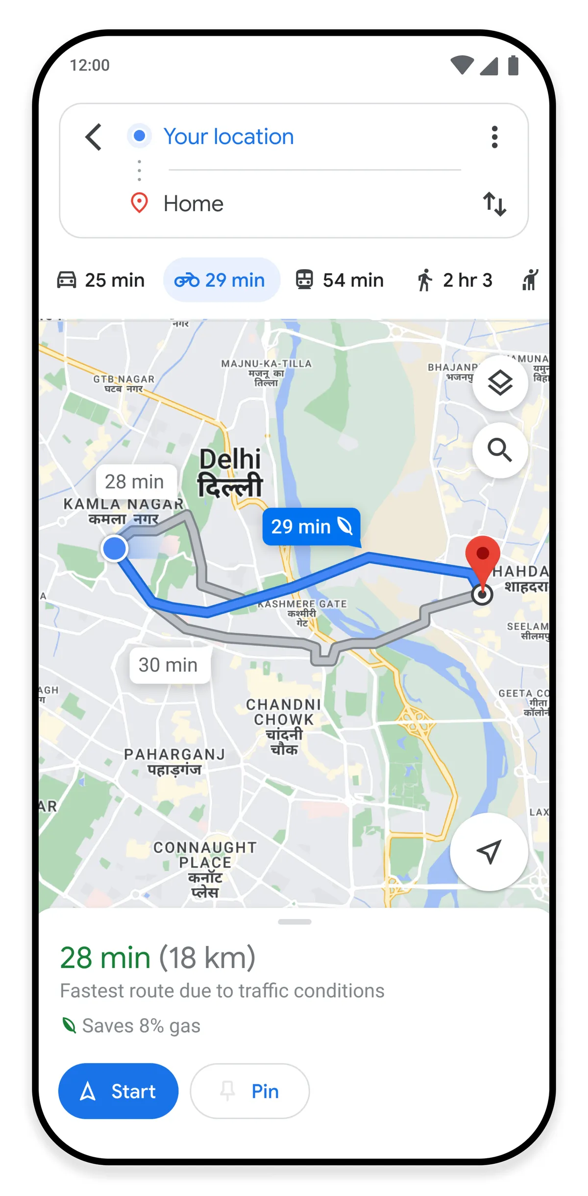
People are looking for information about how to reduce their environmental footprint when in transit — from heading to work to picking up groceries. That’s why we’ll start rolling out fuel-efficient routing in Google Maps to India and Indonesia this year — adding to existing availability in the U.S., Canada, Europe and Egypt. Plus, in these two new countries, we’re including fuel-efficient routes for two-wheelers to help even more people travel more sustainably.
Fuel-efficient routing uses AI to suggest routes that have fewer hills, less traffic, and constant speeds with the same or similar ETA. Since launching in October 2021, it’s estimated to have helped prevent more than 2.4 million metric tons of CO2e emissions — the equivalent of taking approximately 500,000 fuel-based cars off the road for a year. 2
To help people find other sustainable modes of transportation, like rail, new train route suggestions will soon appear on Search when you look for flights. And in the near future, in France, when people look up driving directions, Maps will show public transit or walking suggestions next to driving routes if travel times are comparable and practical.
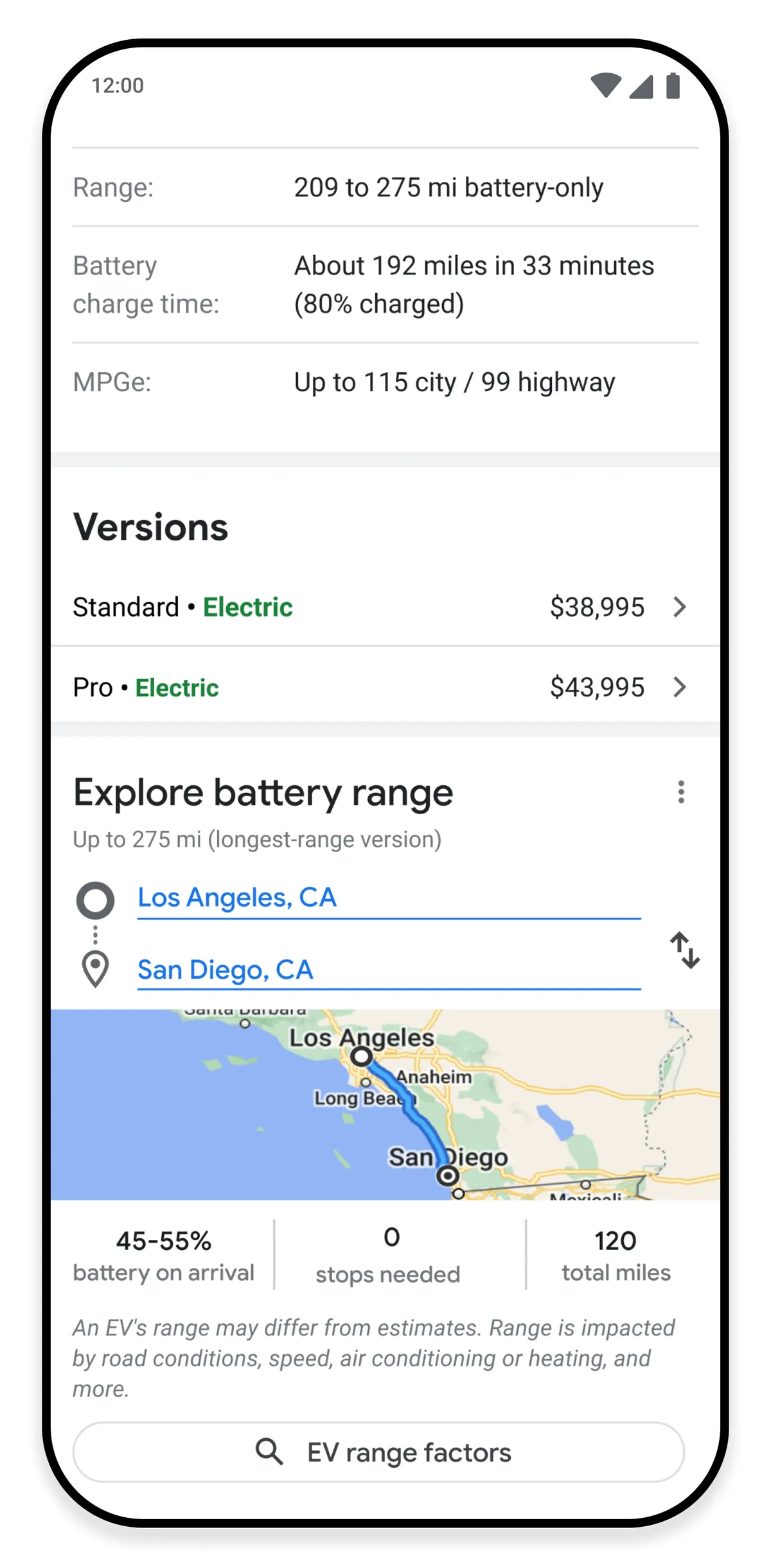
Introducing deeper electric vehicle insights in Search
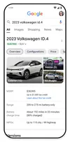
Electric vehicles (EVs) are another area of transportation where we’re seeing growing interest. In fact, global EV-related searches have nearly doubled over the past two years. For people shopping for an EV, it’s now even easier to understand the costs associated with buying a new vehicle thanks to new insights in Search.In the U.S., when people search for terms like “best electric cars,” they can quickly compare prices, battery range and discover models. They can also find federal government incentives for qualifying vehicles in the U.S., with German and French national incentives coming soon.
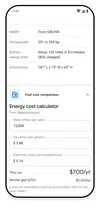
We’re also adding an updated Fuel Cost Calculator to electric and fuel-based car results to help drivers understand the cost of charging compared with filling up at the pump. This is available now in 21 countries around the world.

Our new battery range explorer shows how far drivers can go with a specific model car on a single charge. Drivers can also customize a route to see how many charges are needed along the way based on factors like elevation change and speed limits. These battery range insights roll out in the U.S. in the coming weeks and in Europe early next year.
Minimizing the impact of long-distance travel
Aviation is one of the hardest sectors to decarbonize. Contrails — the thin, white lines you sometimes see behind aircraft — account for roughly 35% of aviation's global warming impact. To mitigate this, Google Research teamed up with American Airlines and Breakthrough Energy to combine AI and huge amounts of data to predict where contrails will form and how planes can avoid making them. This trial reduced contrails by 54%.
Now, we’re broadening our efforts via a new partnership with EUROCONTROL, the European Organization for the Safety of Air Navigation. EUROCONTROL will be able to provide aircraft flying through their airspace with information about how to avoid contrails.

Energy
Sharing information about home cooling and heating options
To help with the clean energy transition, we’re working to provide more information about sustainable options for home energy. Making sense of the options can be overwhelming, and people often need a new system on short notice, like when a boiler breaks in the middle of winter or an air conditioning unit stops working during a record-breaking heatwave. To make it easier for people looking for more sustainable heating and cooling options for their homes, we’re updating our Search experience to show energy efficiency information and financial incentives when people search terms like "heat pumps" or "air conditioning".
Broadening access to tools that accelerate the energy transition
Helping people, businesses and cities source clean energy is also a critical part of the clean energy transition. One of the biggest barriers to bringing more clean energy online is the complex planning process that includes barriers like aging infrastructure and severe weather events that often cause delays. Tapestry, an early Alphabet project, has developed AI-powered tools for grid mapping and planning to help governments and utilities efficiently model scenarios, like taking a coal-based plant offline or how an extreme weather event could impact clean energy sources. With Tapestry’s technology, Coordinador Eléctrico Nacional (CEN), Chile’s national system operator, can simultaneously run up to 12 times the number of future scenarios as their current tool.
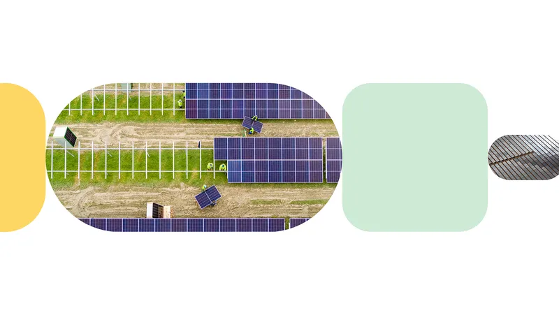
Helping build more sustainable urban areas with solar
Lastly, to help cities better incorporate solar into their development plans, today we’re introducing a new feature in Google Earth. This capability will make it easier for planners to determine the best building designs and solar options for urban areas. It’s especially helpful when optimizing designs for places with ample space, like parking lots. As we continue working toward a carbon-free world, making solar technology more accessible for cities and organizations will be key to reducing global emissions.
There’s more momentum than ever behind efforts to reduce global emissions, and there are so many opportunities to make an impact in areas like transportation and energy. Whether it’s using fuel-efficient routing on the road or designing cities to minimize emissions, our tools share helpful information that enables people to make sustainable decisions. Technology — especially breakthroughs in AI — will advance progress toward a sustainable future.


