10 Google Maps features that help me navigate more confidently
Before Google Maps came along, I got lost while driving more than I’d like to admit. But after many years as a daily Google Maps user — from the early days of printing off maps from my desktop computer to today, with Google Maps as my trusty sidekick anywhere I walk or drive — I no longer worry about getting from A to B.
I’ve also come to appreciate all that Google Maps has to offer beyond just getting me where I need to go. You can discover new places, read reviews and check out menus before you make a stop. You can also check things like air quality and if a place is wheelchair accessible. And with Immersive View, you can actually experience a new place virtually as if you’re really there, thanks to AI and computer vision, and soon, you’ll be able to use this same technology to visualize your entire route. In the meantime, there are already a bunch of helpful Maps tools you can use to make life a little easier. Here are 10 Google Maps features to try on your phone next time you’re ready to get out and about.
1. Navigate an unfamiliar area more easily on foot
Finding your way around a new place on foot can be intimidating. We created Live View walking directions to keep you pointed in the right direction.
To use Live View, just search for a destination in Maps and tap “Directions.” Above the map in the travel mode toolbar, select the icon indicating walking and in the bottom center, tap “Live View.” Follow the on-screen instructions to help Maps find your location, and once it knows where you are, you’ll get directions through the camera view on your screen. Your phone will even vibrate when it’s time to make a turn or you’ve reached your destination. You can even use Live View to navigate tricky places indoors, like airports, train stations, and malls – or to explore an unfamiliar area, just by lifting your phone.
“This was one of the most technically complex features to implement in Maps, since it relies on Street View imagery paired with state-of-the-art AI and augmented reality technology,” says Amanda Leicht Moore, director of Product Management for Maps. “People would always joke that they wished we could draw blue dots on the ground in front of them so they’d always know which way to go, and this gets us pretty close to that!”
2. Find fuel-efficient routes when you drive
If you search for driving directions in Maps across the U.S., Canada and Europe, you’ll have the option to see which route is most fuel efficient. Tapping the route with the leaf icon will show how much fuel (or for drivers of electric vehicles, how much energy) you’ll save by taking the eco-friendly path, and the time difference (if any) between that route and the fastest one.
“This is an easy way to make a small change that can have a big impact,” Amanda says. As of the end of 2022, eco-friendly routing is estimated to have helped prevent more than 1.2 million metric tons of carbon emissions since launch — equivalent to taking approximately 250,000 fuel-based cars off the road for a year.
3. Add multiple destinations to your directions
When you have to make a few stops on your trip, like if you’re picking up a friend and then going to a restaurant for dinner, you can add multiple destinations to your directions in Google Maps. After you search for your first destination, tap “Directions” and then select the three dots in the top right. Tap “Add stop” and search for your next destination. Repeat this process until you’ve added all your stops and then tap “Done.” Google Maps will calculate the best route between all your destinations and give you an estimated arrival time.
You can add up to nine stops to your route, change the order of stops by dragging and dropping them, remove stops and share your directions with others.
4. Download maps to use offline
If you’re driving in areas with spotty phone service, you can still get where you need to go by downloading a map to use offline. Amanda says this was one of Maps’ most requested tools. “It’s one of those features that can really help you out when you otherwise might have gotten lost because of spotty cell service,” she says.
To use this feature, select your profile picture or initial icon in the top right corner of the screen. Tap “Offline maps,” and then choose “Select your own map.” Zoom in or out on the map to select the area you’d like to have access to when offline and then tap “Download.” After that, you can use it to navigate even without an internet connection.
5. Save places you want to check out later
I’m really excited about this feature, which you can use to make lists of places you want to go. It’ll be really helpful for my upcoming family vacation!
“I use saved places all the time,” Amanda says. “Whenever I hear of a new place that I want to check out, I save it to my ‘Want to go’ list. I love that I can also see recent photos, dishes, videos and reviews of that place that other people have added.”
To get started, tap the “Saved” tab at the bottom of the Maps home screen. You can create new lists or add to the standard lists, like “Favorites” and “Want to go.” Once you create a new list, its homepage will pop up with an “Add” button you can use to find locations. Or, if you’ve already found somewhere you want to add to a list, first pull up the location in Maps. Scroll to the right through the chips, tap “Save” and select the list you’d like to add it to. You can also add notes to remind yourself of important information and share your lists, too.
6. Tweak your arrival time to avoid being late
Sometimes getting to your destination on time is really important, like if you have a doctor’s appointment or a dinner reservation. Set an “Arrive by” time in Maps when you’re planning your route to help make sure you won’t be late.
Enter your destination in the search bar and press the three dots in the top right. Then tap “Set depart or arrive time,” enter your desired time and tap “Done” in iOS or “Set” on Android. Maps will then calculate the best route to your destination and give you an estimated arrival time.
7. Read reviews and see inside your destination
Before I visit a new place I usually do a little homework, like checking out what’s on the menu at a new coffee shop or reading reviews for must-try drinks. You can do all this right from Maps. To access all these details at your fingertips, search for a place in Maps and then scroll down to see reviews, photos and videos from other Maps users.
8. Figure out the best time to visit a place
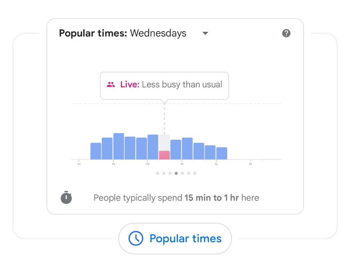
When you’re in a hurry, it’s helpful to know how busy a place will be before you get there. Few things are more frustrating than having to wait in a really long line when you only have a few minutes to grab a bite.
Once you’ve searched for a place on Google Maps, when you scroll down you’ll find a chart showing popular times, which shows you how busy the place typically is during different times of day. You can even see how busy a place is right now so you can save time and avoid long lines.
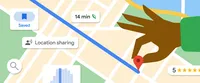
9. Share your location or trip progress with family and friends
Sharing your location with someone helps them know when to expect you to arrive somewhere, but it can also be useful as a safety feature so your loved ones know where you are if needed.
To share your location, tap on your profile and select “Location sharing” to choose people who should have your real-time whereabouts. You can share your location with your Google and phone contacts, or share with a link through a messaging app. You can also set the length of time you’d like to share your location or stop sharing it at any time.
To share your progress on a specific trip, once navigation has started, swipe up from the bottom of the screen to open the navigation bar and tap “Share trip progress.” Select the people you’d like to share your progress with and hit “Share.” The people you’ve selected will be able to see your real-time location on the map and your estimated time of arrival. (You can only share your trip progress with people who are in your contacts.)
10. Search along your route to avoid long detours
One of the past most requested Maps features, according to Amanda, was the ability to search for something along your route. “This continues to be one of the features that people tell me is so useful, usually because they’re running low on gas and need to find a gas station ASAP,” she says.
To search along your route while making your way toward your destination, tap the search icon at the top of the Maps home screen. Either select one of the chips highlighting suggested categories or type what you’re looking for, and Google Maps will show you a list of results. You’ll also see ratings and how many minutes the stop will add to your route, so you can choose the most efficient detour. Just tap your selection, hit “Add stop” and away you go!


