Mapping wildfires with the power of satellite data


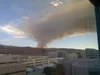
Ten years ago, I was inside the Google office in Haifa, Israel when the devastating Carmel Mountain fire started blazing not far from us. The team started searching the web to learn more. And while we did find some details confirming what we already knew—a large fire was taking place outside of our door—we experienced a potentially life-impacting information gap.
This kick-started our journey to build features in Google Search and other products that connect people with high-quality information during crises. A few hours after I took the photo below, we quickly launched a small feature in Search that made it easier for people to find the emergency hotline for the Carmel Mountain fire. Since then, we’ve continued to evolve and expand off this initial launch into the SOS alerts we launched in 2017.
Carmel Mountain Fire - Photo from Google Office in Haifa, Israel
Connecting people to critical information during active wildfires
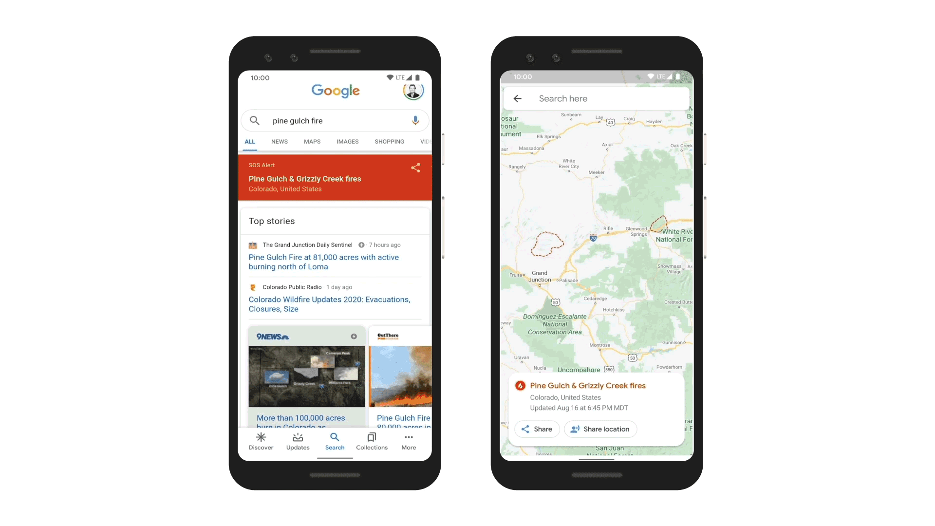
Today we’re launching a new wildfire boundary map in Search and Maps SOS alerts in the U.S. to provide deeper insights for areas impacted by an ongoing wildfire. In moments like a growing wildfire, knowing exactly where a blaze is underway and how to avoid it is critical. Using satellite data to create a wildfire boundary map, people will now see the approximate size and location right on their phone or desktop.
When people look for a specific fire like "Pine Gulch fire" or “Apple fire” in Search, they will be able to see a wildfire’s approximate boundary of the fire, name and location, as well as news articles and helpful resources from local emergency agencies in the SOS alert.
On Google Maps, people will have access to the same details, including the fire boundary, and receive warnings if they’re approaching an active blaze. If someone is exploring an area near a wildfire on Google Maps, they’ll get an ambient alert that will point them to the latest information.
Related: Natural disaster safety tips: a Q&A with the Red Cross
How we map fires to help keep people safe
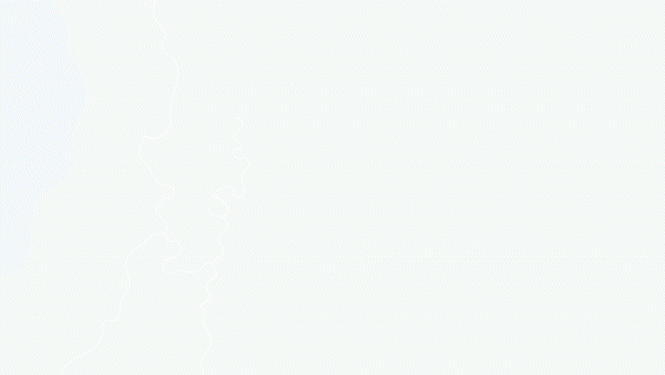
With satellite data from the National Oceanic and Atmospheric Administration’s (NOAA) GOES constellation of satellites and Google Earth Engine’s data analysis capabilities, we’re now able to show the size of a wildfire in near real time, with data being refreshed roughly every hour. NOAA’s satellites include infrared and optical sensors optimized for detecting “hot spots” or large wildfires on the Earth’s surface. We run computations on this data in Earth Engine to identify the affected area.Image series showing smoke from the recent Apple Fire in California, captured by GOES-17 satellite.

From there, we create a digital polygon—the red boundary shown on the map in Search and Google Maps—that represents the approximate wildfire impact area. If multiple large fires are active in the same region, people may see several polygons. You can learn more about how we gather, analyze and visualize wildfire data from satellites on our Medium blog.
Using data from NOAA's GOES satellites and Google Earth Engine, we create a digital polygon to represent the approximate wildfire impact area on Search and Google Maps.
Putting this information to work
This year the National Interagency Fire Center has predicted above normal fire risks for several areas across the U.S. Already, firefighters have confronted large blazes across Northern and Southern California, as well as the Grizzly Creek Fire in Colorado, which led to evacuations and burned thousands of acres. In these situations, having high-quality information at your fingertips matters.
For example, in the recent Apple, Pine Gulch, and Grizzly fires, we quickly identified that the wildfires were rapidly expanding, and dry conditions exacerbated the fire, putting thousands of people at risk. We were able to launch our SOS alerts, with the latest boundary map, on Search and Google Maps.
Last year, we piloted this feature in Search for major California wildfires to confirm it was a useful tool for first responders, emergency management personnel and the community. We collaborated with organizations, like the California Governor's Office of Emergency Services (Cal OES) and Boulder’s Office of Emergency Management, to gather expert recommendations on wildfire preparedness and response. Their feedback throughout our 2019 pilot helped identify what information is most useful during emergency situations.
Google has been involved in crisis response for many years, starting with the Carmel Mountain Fire in Israel in 2010. Since then, we've initiated Public and SOS alerts for hundreds of thousands of crises around the world. From wildfire mapping, to earthquake detection and alerts to flood forecasting, we continue to find new ways for technology to be helpful at the most critical times.