Mapping human activity at sea with AI

General summary
Global Fishing Watch, co-founded by Google, released two new datasets to understand human activity's impact on the seas. These datasets map global ocean infrastructure and non-broadcasting vessels, providing insights into offshore renewables development, carbon emissions from maritime vessels, and marine protection. Researchers used Google Earth Engine and AI to analyze satellite imagery, creating a first-of-its-kind global map depicting daily human activity at sea.
Summaries were generated by Google AI. Generative AI is experimental.Basic explainer
People are doing more and more things in the ocean, like fishing, shipping, and building wind farms.
To manage the ocean better, we need to know where and how people are using it.
Google and Global Fishing Watch made maps that show human activities at sea, like where ships are and where oil rigs are.
This information can help protect the ocean and the animals that live in it.
Explore other styles:
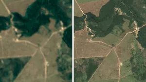
The ocean faces rapid industrialization and competition for space and resources as human activity at sea expands. To better manage the seas, it’s important to understand rising growth in areas like industrial fishing; shipping vessel traffic; oil, gas and wind infrastructure; fish farming and mineral mining. Ahead of World Oceans Day on June 8, Global Fishing Watch, an international nonprofit co-founded by Google, is releasing two new datasets to provide everyone with a more comprehensive understanding of how human activity impacts the seas, global industries, climate, biodiversity and more. The datasets, which map global ocean infrastructure and vessels that aren’t publicly broadcasting their positions, can help advance policy conversations about offshore renewables development, provide insight into carbon dioxide emissions from maritime vessels and enable marine protection.
To create the datasets, Global Fishing Watch researchers used Google Earth Engine, our planetary environmental monitoring platform, to analyze satellite radar and optical imagery across six continents. Similar to how AI can detect sidewalks, street signs and road names to display helpful information in Google Maps, the researchers used Google AI to detect offshore ocean infrastructure and non-broadcasting vessels. This research, published in Nature, allowed the team to create a first-of-its-kind global map that depicts human activity at sea on a daily basis. The maps are powered by Google Earth Engine and Google Cloud BigQuery, and are available today in Global Fishing Watch’s interactive map for analysis and download.
Mapping ocean infrastructure across the globe
Three petabytes of satellite imagery were analyzed to detect offshore infrastructure in coastal waters across six continents. (C) Global Fishing Watch 2024
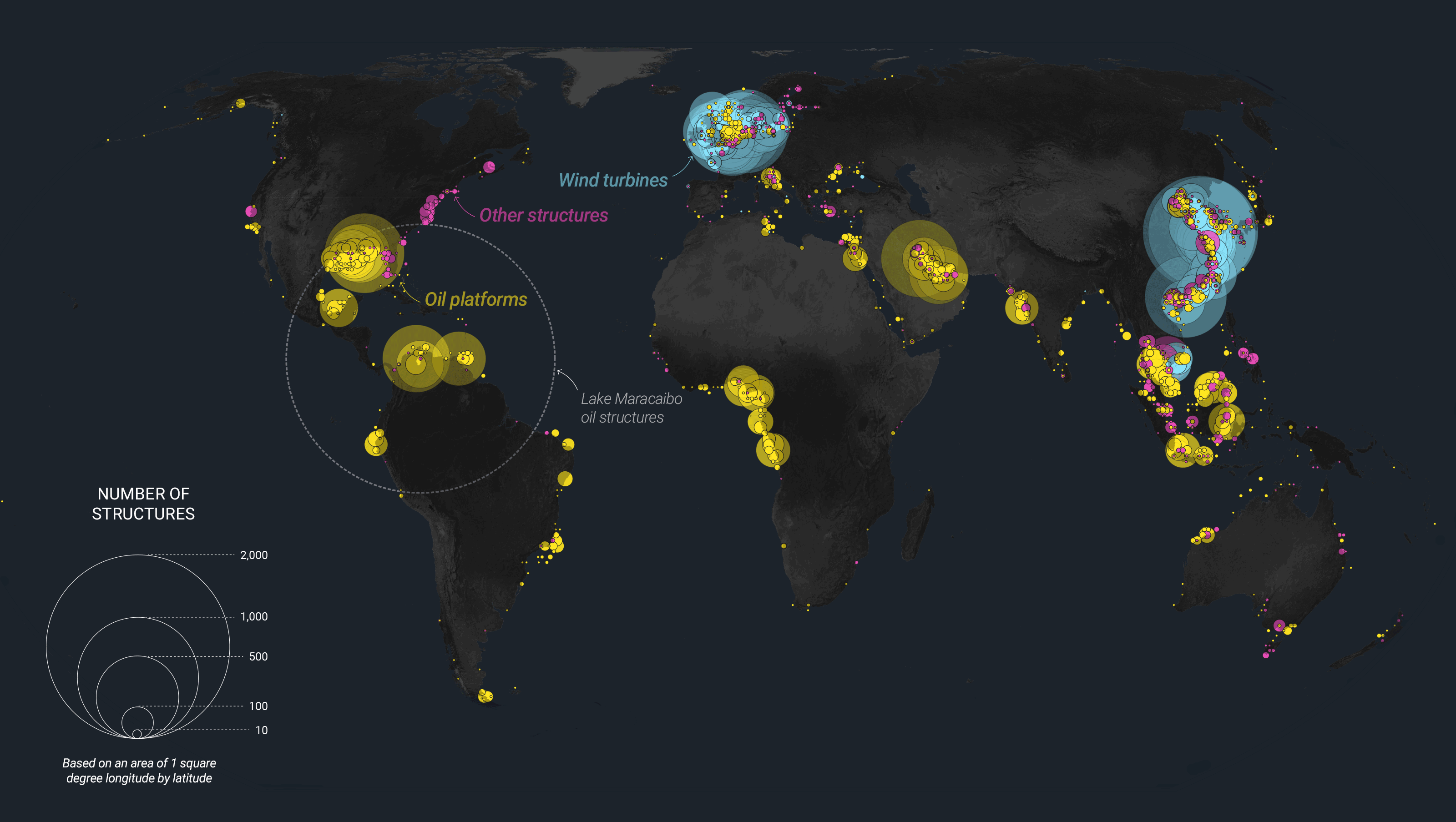
In recent years, offshore development has risen around the world. For example, global oil platforms have increased by approximately 10% since 2017 but are now slowly declining, while wind turbines have nearly tripled; now outnumbering oil platforms. The infrastructure map reflects this data, showing 28,000 offshore structures around the world by 2024, including 10,000 oil and gas drilling platforms, over 14,000 wind turbines and 4,000 structures across aquaculture (fish farms), ship navigation aids (like buoys and towers) and more.
The datasets are now being used to better manage and allocate ocean resources, like offshore wind development, which has the potential to mitigate 10 gigatons of carbon equivalent emissions. Offshore renewable energy developments often face concerns about potential interactions with fishing, shipping, and biodiversity, but there has been a lack of accessible data to enable public discourse around the tradeoffs. Commercial wind developer Ocean Winds is using the datasets to identify the best locations for wind installations and show how they would affect the surrounding areas.
Global offshore energy developments are evolving, with offshore wind structures (blue) now surpassing oil platforms (yellow) as shown here in northern Europe. (C) Global Fishing Watch 2024
Mapping dark fleets and greenhouse gas emissions
In addition to identifying infrastructure, AI and radar imagery from Google Earth Engine detected the presence of “dark vessels,” or ships that don’t publicly broadcast their locations. It was found that globally, half of all large operating vessels aren’t available in public monitoring systems, and that fishing presence is four times larger than previously mapped.
Ocean vessels can be estimated to release over 1 gigaton of carbon annually, with shipping producing 3% of global emissions. To help understand the full extent of greenhouse gas emissions at sea, Global Fishing Watch is joining Climate TRACE, a Google.org supported coalition that tracks emissions, and working with WattTime to measure and attribute sea emissions by country. Carbon release happens on the sea floor, too. Research using Global Fishing Watch found that each year more than 300 megatons of carbon emissions may come from bottom trawling, a fishing method that releases carbon when nets are dragged over the sea floor. This research has in turn informed targeted policy campaigns to restrict this practice.
In West Africa, overfishing from foreign industrial vessels entering country waters has left local fishers with depleted stocks, affecting the local economy and diet. In the region, governments now have a more comprehensive picture of the number of fishing vessels in their waters so they can better patrol high-pressure areas and restore fish populations for local fishermen.
About 75 percent of industrial fishing vessels are not publicly tracked. (C) Global Fishing Watch 2024
Enabling marine protection
Since its founding, Global Fishing Watch’s data has helped governments manage ocean space and assisted in creating 14 marine protected areas (MPAs) to conserve marine and coastal ecosystems. For example, Ascension Island, an MPA located in the Atlantic Ocean between Angola and Brazil, is surrounded by waters that face heavy tuna fishing. The government has used Global Fishing Watch to monitor fleets surrounding their vast MPA as well as observe how climate change is affecting the ecosystem.
These are just a few early examples, but there are so many ways that the datasets can be used to protect the seas and the climate. To help accomplish global sustainability goals, Global Fishing Watch became an official partner of the High Ambition Coalition for Nature and People, a group of 118 countries working to achieve the 30x30 effort to protect 30% of the planet’s land and ocean by 2030. To collectively meet these ambitious goals, we will need the data to manage multiple industrial uses of the ocean, which covers 70% of the planet. We’re proud to provide tools that will help make this possible.