New Maps updates to help you get around Europe more sustainably

With new updates in Maps, we’re making it easier than ever to make sustainable transportation choices across Europe, whether you're planning a summer road trip, commuting to school or work, or running errands.
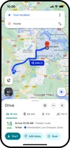
Find driving alternatives
Last year we introduced a feature that uses AI to predict when walking or taking transit will get you to your destination in roughly the same amount of time as driving, and show you recommended walking or transit routes. Since then, this feature has helped people avoid tens of millions of car trips. It’s currently available in over 60 cities, and in the coming months, we’ll launch in Copenhagen, Stockholm, Warsaw, and more.
See helpful details about your cycling route
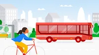
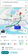
If you’ll be cycling this summer, we’ll show you helpful details about your route in even more places. Now, thanks to partnerships with local governments and data from public authorities, in cities like Hamburg, Madrid, Barcelona, Milan, Rome, Zurich, Budapest, Vienna, and Brussels, you’ll be able to quickly see lanes on your cycling route - along with familiar details like heavy car traffic or steep hills. We’re expanding this experience to 17 new cities, including 9 in Europe, covering 125,000 kilometers of bike lanes globally so you can know when you’ll have a dedicated lane.
Save on petrol and reduce emissions
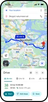
When driving is the best option for your trip, Maps can help you find the most fuel or energy efficient route to your destination, if it isn’t already the fastest one. Fuel efficient routing is now live globally — and with 500 million trips using fuel-efficient routing each month, we estimate collective energy savings that amount to more than 2.7 million metric tons of GHG emissions avoided in 2024 alone. That’s the equivalent of taking more than 630,000 gasoline-powered cars off the road for a year.
Know when you’ll be travelling in low emission zones
Many European cities have designated low-emission and low-traffic zones to decrease air pollution and traffic. Today in places like London and Berlin, we show helpful alerts that let you check if your vehicle is allowed in these zones, and choose an alternate route if needed. In the coming months, we’re expanding this feature to over 1,000 low-emission and low-traffic zones across Europe, including Italy, Sweden, Austria and more.
Helping cities reduce congestion and emissions
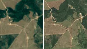
Beyond helping people make more sustainable choices with Maps, we’re also helping cities reduce overall carbon emissions. Project Green Light uses AI and Maps driving trends to model traffic patterns and recommend how cities can optimize their existing traffic light plans. Vilnius, Lithuania is among the cities where we’ve recently expanded Green Light, making it now available in 20 total cities across 4 continents, helping drivers sail through more green lights.
With more ways to get around in Europe, you can choose the option that works best for you. Check out these updates to see how Maps, Search, Gemini, and Lens can help with your summer travel plans.